
Imphal topographic map
Click on the map to display elevation.
About this map
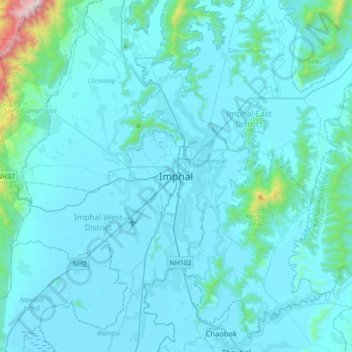
Name: Imphal topographic map, elevation, terrain.
Location: Imphal, Lamphelpat, Imphal West, Manipur, 795001, India (24.63912 93.77644 24.95912 94.09644)
Average elevation: 2,825 ft
Minimum elevation: 2,516 ft
Maximum elevation: 7,572 ft
Other topographic maps
Click on a map to view its topography, its elevation and its terrain.