
Doi Suthep topographic map
Interactive map
Click on the map to display elevation.
About this map
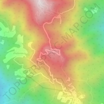
Name: Doi Suthep topographic map, elevation, terrain.
Location: Doi Suthep, Chiang Mai, Chiang Mai Province, Thailand (18.81656 98.89231 18.81666 98.89241)
Average elevation: 4,432 ft
Minimum elevation: 3,225 ft
Maximum elevation: 5,446 ft
Other topographic maps
Click on a map to view its topography, its elevation and its terrain.
Lamhuai Phi Ba
Thailand > Chiang Mai Province > Chiang Mai
Lamhuai Phi Ba, Chiang Mai, Chiang Mai Province, Thailand
Average elevation: 1,736 ft
Mae Ngat Sombun Chon Dam
Thailand > Chiang Mai Province > Chiang Mai
Mae Ngat Sombun Chon Dam, Chiang Mai, Chiang Mai Province, Thailand
Average elevation: 1,289 ft