
海山云台山风景区 topographic map
Interactive map
Click on the map to display elevation.
About this map
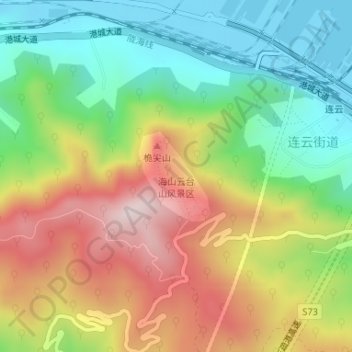
Name: 海山云台山风景区 topographic map, elevation, terrain.
Location: 海山云台山风景区, 连云街道, 连云区, 连云港市, 江苏省, 中国 (34.72385 119.43399 34.73072 119.44064)
Average elevation: 830 ft
Minimum elevation: 0 ft
Maximum elevation: 1,955 ft