
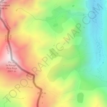
Étang de la Soucarrane topographic map
Interactive map
Click on the map to display elevation.
About this map
Name: Étang de la Soucarrane topographic map, elevation, terrain.
Average elevation: 7,569 ft
Minimum elevation: 5,942 ft
Maximum elevation: 9,485 ft
Other topographic maps
Click on a map to view its topography, its elevation and its terrain.
Étang de Soulcem
Étang de Soulcem, D 8, Auzat, Foix, Ariège, Occitanie, France métropolitaine, 09220, France
Average elevation: 6,470 ft