
Alaçatı Mahallesi topographic map
Interactive map
Click on the map to display elevation.
About this map
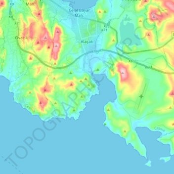
Name: Alaçatı Mahallesi topographic map, elevation, terrain.
Location: Alaçatı Mahallesi, Çeşme, Izmir, Aegean Region, Turkey (38.19830 26.33460 38.30461 26.49612)
Average elevation: 131 ft
Minimum elevation: -3 ft
Maximum elevation: 705 ft
Other topographic maps
Click on a map to view its topography, its elevation and its terrain.