
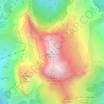
La Tournette topographic map
Interactive map
Click on the map to display elevation.
About this map
Name: La Tournette topographic map, elevation, terrain.
Average elevation: 5,741 ft
Minimum elevation: 4,049 ft
Maximum elevation: 7,602 ft
Other topographic maps
Click on a map to view its topography, its elevation and its terrain.
Vérel
France > Auvergne-Rhône-Alpes > Upper Savoy > Talloires-Montmin
Vérel, Talloires, Talloires-Montmin, Annecy, Upper Savoy, Auvergne-Rhône-Alpes, Metropolitan France, 74290, France
Average elevation: 2,894 ft