Uludoruk Dağı topographic map
Interactive map
Click on the map to display elevation.
About this map
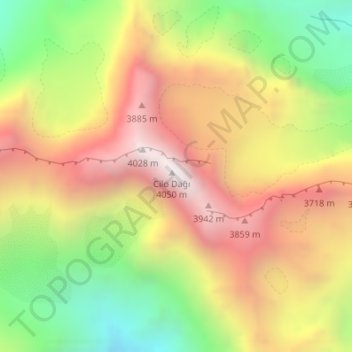
Name: Uludoruk Dağı topographic map, elevation, terrain.
Average elevation: 11,033 ft
Minimum elevation: 8,530 ft
Maximum elevation: 13,383 ft

Click on the map to display elevation.
Name: Uludoruk Dağı topographic map, elevation, terrain.
Average elevation: 11,033 ft
Minimum elevation: 8,530 ft
Maximum elevation: 13,383 ft