
Thank you for supporting this site ❤️
Make a donation
Make a donation
Gear up for your next adventure:
As an Amazon Associate, this site earns from qualifying purchases at no extra cost to you.
Verl topographic map
Click on the map to display elevation.
Thank you for supporting this site ❤️
Make a donation
Make a donation
Gear up for your next adventure:
As an Amazon Associate, this site earns from qualifying purchases at no extra cost to you.
About this map
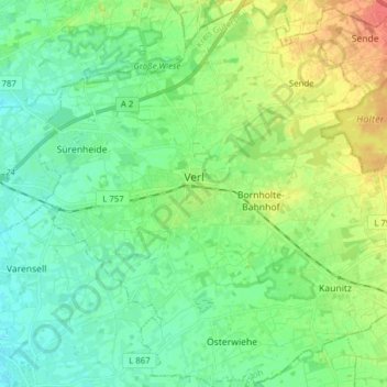
Name: Verl topographic map, elevation, terrain.
Location: Verl, Kreis Gütersloh, North Rhine-Westphalia, 33415, Germany (51.83103 8.44610 51.92646 8.60149)
Average elevation: 305 ft
Minimum elevation: 259 ft
Maximum elevation: 397 ft
Thank you for supporting this site ❤️
Make a donation
Make a donation
Gear up for your next adventure:
As an Amazon Associate, this site earns from qualifying purchases at no extra cost to you.