
Bruchmühlbach-Miesau topographic map
Interactive map
Click on the map to display elevation.
About this map
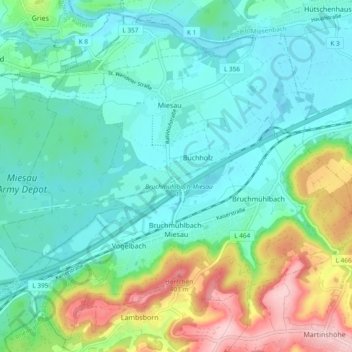
Name: Bruchmühlbach-Miesau topographic map, elevation, terrain.
Average elevation: 896 ft
Minimum elevation: 722 ft
Maximum elevation: 1,394 ft
Other topographic maps
Click on a map to view its topography, its elevation and its terrain.
Trippstadt
Allemagne > Rhénanie-Palatinat > Landkreis Kaiserslautern
Trippstadt, Landstuhl, Landkreis Kaiserslautern, Rhénanie-Palatinat, 67705, Allemagne
Average elevation: 1,329 ft