
Contamana topographic map
Interactive map
Click on the map to display elevation.
About this map
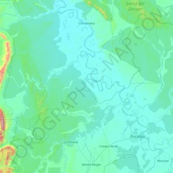
Name: Contamana topographic map, elevation, terrain.
Location: Contamana, Provincia de Ucayali, Loreto, Perú (-8.71614 -75.98556 -7.13927 -74.49950)
Average elevation: 722 ft
Minimum elevation: 384 ft
Maximum elevation: 7,149 ft