
Manhartsberg topographic map
Interactive map
Click on the map to display elevation.
About this map
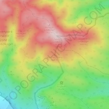
Name: Manhartsberg topographic map, elevation, terrain.
Average elevation: 1,713 ft
Minimum elevation: 1,102 ft
Maximum elevation: 2,293 ft
Other topographic maps
Click on a map to view its topography, its elevation and its terrain.
Bad Vöslau
Österreich > Niederösterreich > Bad Vöslau
Bad Vöslau, Bezirk Baden, Niederösterreich, 2450, Österreich
Average elevation: 981 ft