
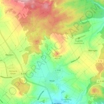
Maar topographic map
Interactive map
Click on the map to display elevation.
About this map
Name: Maar topographic map, elevation, terrain.
Location: Maar, Lauterbach (Hessen), Vogelsbergkreis, Hessen, Duitsland (50.64737 9.35088 50.70406 9.42864)
Average elevation: 1,224 ft
Minimum elevation: 965 ft
Maximum elevation: 1,555 ft
Other topographic maps
Click on a map to view its topography, its elevation and its terrain.
Eichelsachsen
Duitsland > Hessen > Vogelsbergkreis
Eichelsachsen, Schotten, Vogelsbergkreis, Hessen, Duitsland
Average elevation: 1,010 ft
Grebenau
Duitsland > Hessen > Vogelsbergkreis
Grebenau, Vogelsbergkreis, Hessen, 36323, Duitsland
Average elevation: 1,191 ft