
Cedarville Station topographic map
Interactive map
Click on the map to display elevation.
About this map
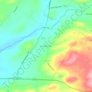
Name: Cedarville Station topographic map, elevation, terrain.
Average elevation: 1,352 ft
Minimum elevation: 1,188 ft
Maximum elevation: 1,654 ft
Other topographic maps
Click on a map to view its topography, its elevation and its terrain.
Chepachet
United States > New York > Herkimer County > Town of Winfield
Chepachet, Town of Winfield, Herkimer County, New York, United States
Average elevation: 1,339 ft
Birmingham Corners
United States > New York > Herkimer County > Town of Winfield
Birmingham Corners, Town of Winfield, Herkimer County, New York, 13491, United States
Average elevation: 1,368 ft
Woods Corners
United States > New York > Herkimer County > Town of Winfield
Woods Corners, Town of Winfield, Herkimer County, New York, 13491, United States
Average elevation: 1,371 ft