
Wil topographic map
Interactive map
Click on the map to display elevation.
About this map
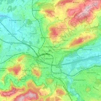
Name: Wil topographic map, elevation, terrain.
Location: Wil, Wahlkreis Wil, San Gallo, 9500, Svizzera (47.42544 9.00232 47.50544 9.08232)
Average elevation: 1,949 ft
Minimum elevation: 1,608 ft
Maximum elevation: 2,559 ft