
Tohogne topographic map
Interactive map
Click on the map to display elevation.
About this map
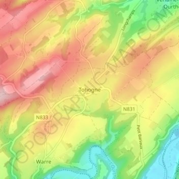
Name: Tohogne topographic map, elevation, terrain.
Location: Tohogne, Durbuy, Luxemburg, Wallonië, 6941, België (50.36104 5.46141 50.40104 5.50141)
Average elevation: 774 ft
Minimum elevation: 423 ft
Maximum elevation: 1,099 ft