
Thank you for supporting this site ❤️
Make a donation
Make a donation
Gear up for your next adventure:
As an Amazon Associate, this site earns from qualifying purchases at no extra cost to you.
Cronchamps topographic map
Click on the map to display elevation.
Thank you for supporting this site ❤️
Make a donation
Make a donation
Gear up for your next adventure:
As an Amazon Associate, this site earns from qualifying purchases at no extra cost to you.
About this map
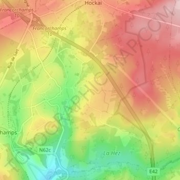
Name: Cronchamps topographic map, elevation, terrain.
Location: Cronchamps, Stavelot, Verviers, Liège, Wallonia, 4970, Belgium (50.44258 5.96521 50.48258 6.00521)
Average elevation: 1,660 ft
Minimum elevation: 1,273 ft
Maximum elevation: 2,008 ft
Thank you for supporting this site ❤️
Make a donation
Make a donation
Gear up for your next adventure:
As an Amazon Associate, this site earns from qualifying purchases at no extra cost to you.
Other topographic maps
Click on a map to view its topography, its elevation and its terrain.