Geolocate

Longos topographic map

Click on the map to display elevation.

About this map

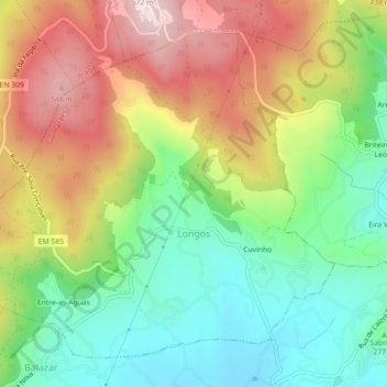
Name: Longos topographic map, elevation, terrain.

Location: Longos, Guimarães, Braga, Portugal (41.50955 -8.39197 41.53790 -8.34727)

Average elevation: 1,076 ft

Minimum elevation: 482 ft

Maximum elevation: 1,870 ft

Gear up for your next adventure:

🪶Compact Camp Shovel - Folding shovel for campsite tasks
📡Handheld GPS Device - Reliable handheld GPS for outdoor navigation
📶Satellite Messenger - Communication device off‑grid
🗻Climbing Gear Basics - Essential gear for beginner climbers
🧭GPS Watch Accessories - Bands and chargers for GPS watches

As an Amazon Associate, this site earns from qualifying purchases at no extra cost to you.