Geolocate

Chornobyl topographic map

Click on the map to display elevation.

About this map
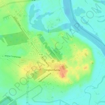
Name: Chornobyl topographic map, elevation, terrain.

Location: Chornobyl, Vyshhorod Raion, Kyiv Oblast, 07270, Ukraine (51.26105 30.19563 51.28992 30.24375)

Average elevation: 371 ft

Minimum elevation: 325 ft

Maximum elevation: 456 ft

Gear up for your next adventure:

🦟Ultrasonic Repellers - Create a bug-free zone at your camp or rest stop
🎒Trail Energy Bars - High‑calorie bars for hiking energy
🔦Powerful Headlamps - Ultra-bright hands-free lighting for night navigation
📱Solar Portable Charger - Solar power bank for charging devices off‑grid
🗺️NatGeo Topo Maps - High-quality waterproof printed topographic maps of US Parks

As an Amazon Associate, this site earns from qualifying purchases at no extra cost to you.