
Caserta topographic map
Interactive map
Click on the map to display elevation.
About this map
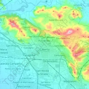
Name: Caserta topographic map, elevation, terrain.
Location: Caserta, Campania, 81100, Italy (41.04330 14.27862 41.13373 14.43474)
Average elevation: 463 ft
Minimum elevation: 56 ft
Maximum elevation: 2,018 ft