
Thank you for supporting this site ❤️
Make a donation
Make a donation
Gear up for your next adventure:
As an Amazon Associate, this site earns from qualifying purchases at no extra cost to you.
Trockau topographic map
Click on the map to display elevation.
Thank you for supporting this site ❤️
Make a donation
Make a donation
Gear up for your next adventure:
As an Amazon Associate, this site earns from qualifying purchases at no extra cost to you.
About this map
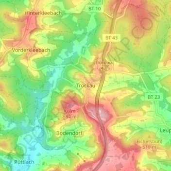
Name: Trockau topographic map, elevation, terrain.
Location: Trockau, Pegnitz, Landkreis Bayreuth, Bavaria, Germany (49.80303 11.47300 49.84303 11.51300)
Average elevation: 1,644 ft
Minimum elevation: 1,385 ft
Maximum elevation: 1,939 ft
Thank you for supporting this site ❤️
Make a donation
Make a donation
Gear up for your next adventure:
As an Amazon Associate, this site earns from qualifying purchases at no extra cost to you.