
Suc-et-Sentenac topographic map
Interactive map
Click on the map to display elevation.
About this map
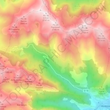
Name: Suc-et-Sentenac topographic map, elevation, terrain.
Average elevation: 5,043 ft
Minimum elevation: 2,310 ft
Maximum elevation: 7,172 ft
Le 17 décembre 2003, un avion de transport militaire CASA CN 235 n° 43F s'est écrasé à environ 1 800 m d'altitude près du pic du Pioulou. Aucun des 7 membres d'équipage n'a survécu. Une stèle est installée sur la D 18A, à l'entrée de Suc en venant de Sentenac.