
La Pulgosa topographic map
Interactive map
Click on the map to display elevation.
About this map
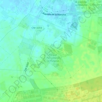
Name: La Pulgosa topographic map, elevation, terrain.
Location: La Pulgosa, Albacete, Castilla-La Mancha, 02006, España (38.95601 -1.87802 38.97601 -1.85802)
Average elevation: 2,270 ft
Minimum elevation: 2,244 ft
Maximum elevation: 2,303 ft
Other topographic maps
Click on a map to view its topography, its elevation and its terrain.
Albacete
España > Castilla-La Mancha > Albacete
Albacete, Castilla-La Mancha, 02001, España
Average elevation: 2,352 ft
Campillo de las Doblas
España > Castilla-La Mancha > Albacete > Campillo de las Doblas
Campillo de las Doblas, Albacete, Castilla-La Mancha, 02511, España
Average elevation: 2,805 ft
Las Tolleras
España > Castilla-La Mancha > Albacete
Las Tolleras, Albacete, Castilla-La Mancha, España
Average elevation: 2,825 ft