
如丙岗村 topographic map
Interactive map
Click on the map to display elevation.
About this map
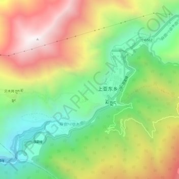
Name: 如丙岗村 topographic map, elevation, terrain.
Location: 如丙岗村, 上亚东乡, 亚东县, 日喀则市, 西藏自治区, 中国 (27.49998 88.94511 27.53998 88.98511)
Average elevation: 12,008 ft
Minimum elevation: 10,095 ft
Maximum elevation: 14,475 ft