

Mount Charleston topographic map
Click on the map to display elevation.
Mount Charleston
The town of Mount Charleston is named for nearby Mount Charleston whose Charleston Peak at 11,916 feet (3,632 m) is the highest point in Clark County. The town of Mount Charleston is in a valley of the Spring Mountains to the northwest of Las Vegas, noted for its hiking trails. It is also known for its Retreat on Charleston Peak, a 64-room hotel. At an elevation of approximately 7,500 feet, temperatures are much lower than in Las Vegas, which has an elevation of about 2,000 feet, making it a popular place for Las Vegans to vacation. The mean high temperature is 20.4 degrees (Fahrenheit) cooler than in Las Vegas. The area is also known as a vacation village for wealthy Las Vegas residents.
About this map
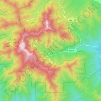
Name: Mount Charleston topographic map, elevation, terrain.
Location: Mount Charleston, Clark County, Nevada, United States (36.21891 -115.69669 36.30926 -115.51398)
Average elevation: 8,399 ft
Minimum elevation: 6,027 ft
Maximum elevation: 11,896 ft
Clark County trails, hiking, mountain biking, running and outdoor activities