
Brutinel topographic map
Interactive map
Click on the map to display elevation.
About this map
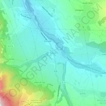
Name: Brutinel topographic map, elevation, terrain.
Average elevation: 3,619 ft
Minimum elevation: 3,120 ft
Maximum elevation: 5,387 ft
Other topographic maps
Click on a map to view its topography, its elevation and its terrain.
Villard de Laye
France > Provence-Alpes-Côte d'Azur > Hautes-Alpes > Laye
Villard de Laye, Laye, Gap, Hautes-Alpes, Provence-Alpes-Côte d'Azur, France métropolitaine, 05500, France
Average elevation: 4,019 ft
Canard
France > Provence-Alpes-Côte d'Azur > Hautes-Alpes > Laye > Canard
Canard, Laye, Gap, Hautes-Alpes, Provence-Alpes-Côte d'Azur, France métropolitaine, 05500, France
Average elevation: 4,275 ft