
Mayen topographic map
Interactive map
Click on the map to display elevation.
About this map
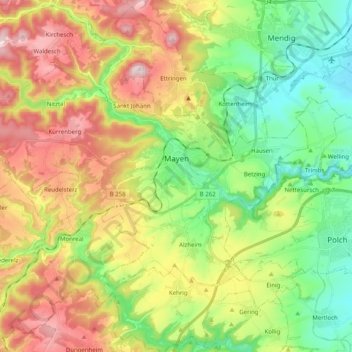
Name: Mayen topographic map, elevation, terrain.
Average elevation: 1,086 ft
Minimum elevation: 531 ft
Maximum elevation: 1,886 ft
Other topographic maps
Click on a map to view its topography, its elevation and its terrain.
Herresbach
Allemagne > Rhénanie-Palatinat > Landkreis Mayen-Koblenz
Herresbach, Vordereifel, Landkreis Mayen-Koblenz, Rhénanie-Palatinat, Allemagne
Average elevation: 1,759 ft