
Tambre topographic map
Interactive map
Click on the map to display elevation.
About this map
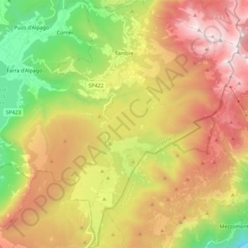
Name: Tambre topographic map, elevation, terrain.
Location: Tambre, Belluno, Veneto, Italia (46.04135 12.37582 46.15329 12.49709)
Average elevation: 3,622 ft
Minimum elevation: 279 ft
Maximum elevation: 7,257 ft
Other topographic maps
Click on a map to view its topography, its elevation and its terrain.