
Thank you for supporting this site ❤️
Make a donation
Make a donation
Gear up for your next adventure:
As an Amazon Associate, this site earns from qualifying purchases at no extra cost to you.
Cimenyan topographic map
Click on the map to display elevation.
Thank you for supporting this site ❤️
Make a donation
Make a donation
Gear up for your next adventure:
As an Amazon Associate, this site earns from qualifying purchases at no extra cost to you.
About this map
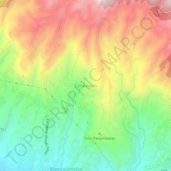
Name: Cimenyan topographic map, elevation, terrain.
Location: Cimenyan, Bandung Regency, West Java, Java, 40197, Indonesia (-6.88322 107.65419 -6.84322 107.69419)
Average elevation: 3,474 ft
Minimum elevation: 2,510 ft
Maximum elevation: 4,616 ft
Thank you for supporting this site ❤️
Make a donation
Make a donation
Gear up for your next adventure:
As an Amazon Associate, this site earns from qualifying purchases at no extra cost to you.