
Bad Rappenau topographic map
Interactive map
Click on the map to display elevation.
About this map
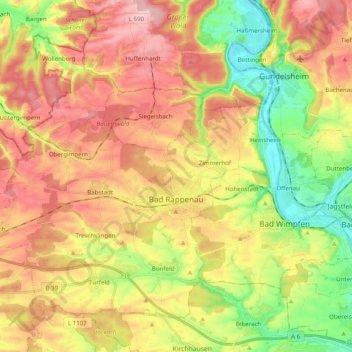
Name: Bad Rappenau topographic map, elevation, terrain.
Average elevation: 771 ft
Minimum elevation: 456 ft
Maximum elevation: 1,070 ft
Other topographic maps
Click on a map to view its topography, its elevation and its terrain.
Cleebronn
Duitsland > Baden-Württemberg > Landkreis Heilbronn
Cleebronn, Verwaltungsgemeinschaft Brackenheim, Landkreis Heilbronn, Baden-Württemberg, 74389, Duitsland
Average elevation: 906 ft
Löwenstein
Duitsland > Baden-Württemberg > Landkreis Heilbronn
Löwenstein, Verwaltungsgemeinschaft Obersulm, Landkreis Heilbronn, Baden-Württemberg, 74245, Duitsland
Average elevation: 1,178 ft