
Mount Luigi di Savoia topographic map
Interactive map
Click on the map to display elevation.
About this map
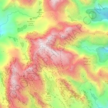
Name: Mount Luigi di Savoia topographic map, elevation, terrain.
Average elevation: 13,497 ft
Minimum elevation: 11,470 ft
Maximum elevation: 15,112 ft
Other topographic maps
Click on a map to view its topography, its elevation and its terrain.
Coronation Glacier
Coronation Glacier, South Ridge Route, Kasese, Western Region, Uganda
Average elevation: 14,452 ft