Geolocate

Fletching topographic map

Click on the map to display elevation.

About this map

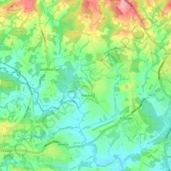
Name: Fletching topographic map, elevation, terrain.

Location: Fletching, Wealden, East Sussex, England, United Kingdom (50.96425 -0.02012 51.02855 0.08215)

Average elevation: 154 ft

Minimum elevation: 30 ft

Maximum elevation: 427 ft

Gear up for your next adventure:

Backpacking Tent - Lightweight and durable tent for multi‑day hikes
🪓Survival Multi‑Tool - Versatile tool for camp and trail tasks
🚑Emergency Bivvies - Heat-reflective sleeping bags for survival situations
🗺️Topographic Maps - Detailed topo maps for hiking, exploring and outdoor navigation
🎒Outdoor Daypacks - Lightweight backpacks designed for carrying maps and essential gear

As an Amazon Associate, this site earns from qualifying purchases at no extra cost to you.