
Friesack topographic map
Interactive map
Click on the map to display elevation.
About this map
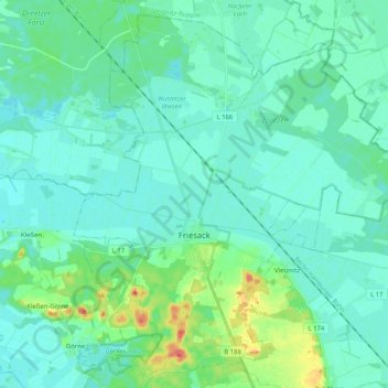
Name: Friesack topographic map, elevation, terrain.
Location: Friesack, Havelland, Brandenburg, 14662, Germany (52.69498 12.51372 52.81061 12.72066)
Average elevation: 112 ft
Minimum elevation: 79 ft
Maximum elevation: 243 ft