
Thank you for supporting this site ❤️
Make a donation
Make a donation
Gear up for your next adventure:
As an Amazon Associate, this site earns from qualifying purchases at no extra cost to you.
Idlewild topographic map
Click on the map to display elevation.
Thank you for supporting this site ❤️
Make a donation
Make a donation
Gear up for your next adventure:
As an Amazon Associate, this site earns from qualifying purchases at no extra cost to you.
About this map
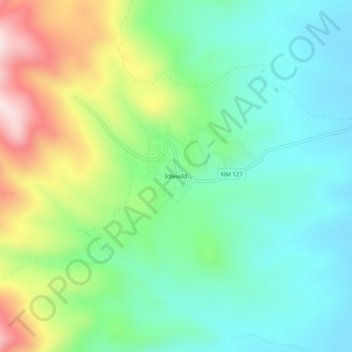
Name: Idlewild topographic map, elevation, terrain.
Location: Idlewild, Colfax County, New Mexico, 87718, United States (36.52948 -105.32528 36.56948 -105.28528)
Average elevation: 8,730 ft
Minimum elevation: 8,264 ft
Maximum elevation: 9,734 ft
New Mexico trails, hiking, mountain biking, running and outdoor activities
Thank you for supporting this site ❤️
Make a donation
Make a donation
Gear up for your next adventure:
As an Amazon Associate, this site earns from qualifying purchases at no extra cost to you.