
Cibinong topographic map
Click on the map to display elevation.
About this map
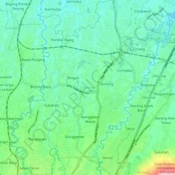
Name: Cibinong topographic map, elevation, terrain.
Location: Cibinong, Bogor, West Java, Indonesia (-6.52909 106.79723 -6.43596 106.87633)
Average elevation: 436 ft
Minimum elevation: 266 ft
Maximum elevation: 1,027 ft
Other topographic maps
Click on a map to view its topography, its elevation and its terrain.
Bojonggenteng
Indonesia > West Java > Bogor > Parung Panjang > Gintung Cilejet
Average elevation: 161 ft
Mount Salak
Mount Salak is popular for many mountain climbing clubs, especially Route II, because of the difficulty involved in reaching the peak. Climbers bring water with them, especially through Post I at Kawah Ratu Route. A water source, supplied by rain, exists at an altitude of 2,211 m (7,254 ft) on this route.
Average elevation: 5,807 ft