
Nyngan topographic map
Interactive map
Click on the map to display elevation.
About this map
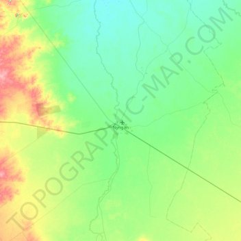
Name: Nyngan topographic map, elevation, terrain.
Average elevation: 594 ft
Minimum elevation: 522 ft
Maximum elevation: 833 ft
Other topographic maps
Click on a map to view its topography, its elevation and its terrain.
Miandetta
Australia > New South Wales > Bogan Shire Council
Miandetta, Bogan Shire Council, New South Wales, 2825, Australia
Average elevation: 636 ft
Hermidale
Australia > New South Wales > Bogan Shire Council > Hermidale
Hermidale, Bogan Shire Council, New South Wales, 2831, Australia
Average elevation: 771 ft