
Caldeira topographic map
Interactive map
Click on the map to display elevation.
About this map
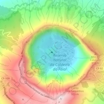
Name: Caldeira topographic map, elevation, terrain.
Location: Caldeira, Cedros, Horta, Faial, Açores, 9900-472, Portugal (38.58803 -28.71614 38.58813 -28.71604)
Average elevation: 2,602 ft
Minimum elevation: 1,867 ft
Maximum elevation: 3,445 ft