
Freesenberg topographic map
Interactive map
Click on the map to display elevation.
About this map
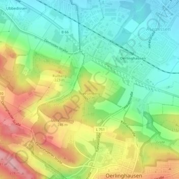
Name: Freesenberg topographic map, elevation, terrain.
Average elevation: 620 ft
Minimum elevation: 436 ft
Maximum elevation: 892 ft
Other topographic maps
Click on a map to view its topography, its elevation and its terrain.
Merkslohberg
Deutschland > Nordrhein-Westfalen > Kreis Lippe > Leopoldshöhe
Merkslohberg, Leopoldshöhe, Kreis Lippe, Nordrhein-Westfalen, 33813, Deutschland
Average elevation: 686 ft
Leopoldshöhe
Deutschland > Nordrhein-Westfalen > Kreis Lippe > Leopoldshöhe
Leopoldshöhe, Kreis Lippe, Nordrhein-Westfalen, Deutschland
Average elevation: 390 ft