
Snowden topographic map
Click on the map to display elevation.
About this map
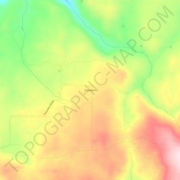
Name: Snowden topographic map, elevation, terrain.
Location: Snowden, Klickitat County, Washington, United States (45.81234 -121.37369 45.85234 -121.33369)
Average elevation: 2,247 ft
Minimum elevation: 1,657 ft
Maximum elevation: 2,779 ft
Klickitat County trails, hiking, mountain biking, running and outdoor activities
Other topographic maps
Click on a map to view its topography, its elevation and its terrain.
Columbia River Gorge National Scenic Area
United States > Washington > Klickitat County
The Columbia River, Klamath River in northern California, Pit River in northern California, and Fraser River in southern British Columbia are the only four rivers connecting the watersheds on the east side of the Cascade Range to the Pacific Ocean. Each river has carved out a gorge through the Cascades. The…
Average elevation: 2,372 ft
Goldendale
United States > Washington > Klickitat County
Goldendale's elevation at the County Courthouse is 498 meters (1,634 feet).
Average elevation: 1,686 ft
Observatory Hill State Park
United States > Washington > Klickitat County > Goldendale
Average elevation: 1,772 ft
Goldendale
United States > Washington > Klickitat County
Goldendale's elevation at the County Courthouse is 498 meters (1,634 feet).
Average elevation: 1,686 ft