
Forch topographic map
Interactive map
Click on the map to display elevation.
About this map
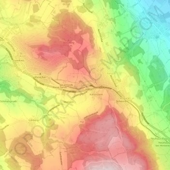
Name: Forch topographic map, elevation, terrain.
Location: Forch, Küsnacht, Bezirk Meilen, Zürich, 8700, Schweiz (47.30555 8.62681 47.34555 8.66681)
Average elevation: 2,123 ft
Minimum elevation: 1,427 ft
Maximum elevation: 2,648 ft
Other topographic maps
Click on a map to view its topography, its elevation and its terrain.
Küsnacht
Schweiz > Zürich > Bezirk Meilen > Küsnacht
Küsnacht, Bezirk Meilen, Zürich, 8700, Schweiz
Average elevation: 1,660 ft