
Castro Caldelas topographic map
Interactive map
Click on the map to display elevation.
About this map
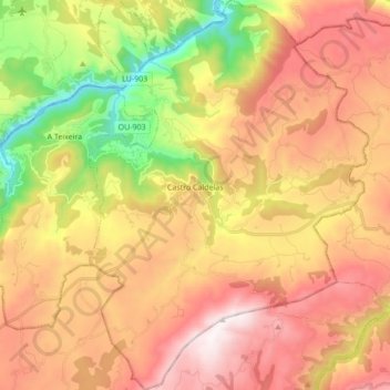
Name: Castro Caldelas topographic map, elevation, terrain.
Location: Castro Caldelas, Terra de Caldelas, Ourense, Galicien, Spanien (42.30852 -7.46210 42.43556 -7.33857)
Average elevation: 2,546 ft
Minimum elevation: 666 ft
Maximum elevation: 4,213 ft