
Sprucedale topographic map
Interactive map
Click on the map to display elevation.
About this map
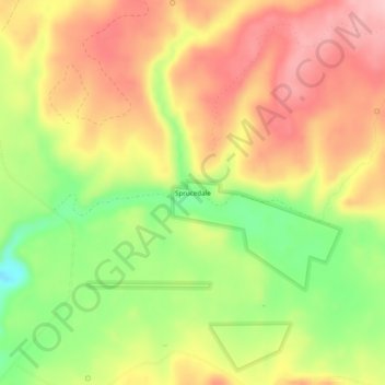
Name: Sprucedale topographic map, elevation, terrain.
Location: Sprucedale, Greenlee County, Arizona, USA (33.72033 -109.34703 33.76033 -109.30703)
Average elevation: 7,684 ft
Minimum elevation: 7,385 ft
Maximum elevation: 7,920 ft