
Malagueira topographic map
Interactive map
Click on the map to display elevation.
About this map
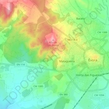
Name: Malagueira topographic map, elevation, terrain.
Location: Malagueira, Évora, Portugal (38.54362 -7.97856 38.60367 -7.91290)
Average elevation: 899 ft
Minimum elevation: 725 ft
Maximum elevation: 1,214 ft
Other topographic maps
Click on a map to view its topography, its elevation and its terrain.