
Goshta topographic map
Interactive map
Click on the map to display elevation.
About this map
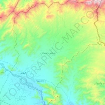
Name: Goshta topographic map, elevation, terrain.
Location: Goshta, Nangarhar Province, Afghanistan (34.27781 70.72743 34.56391 71.02525)
Average elevation: 3,054 ft
Minimum elevation: 1,496 ft
Maximum elevation: 8,068 ft
The Goshta district is located on the Durand Line between Afghanistan and the Khyber Pakhtunkhwa province of Pakistan. From the highlands that define the border, dry hilly country with seasonal streams slopes down to the flat land along the north side of the Kunar river valley where most of the people live, at an elevation of about 540 m. Average temperatures in the valley range from 3o in January to 27o in July.[3] Precipitation is low, perhaps 150mm per year, mostly falling in the spring.
Other topographic maps
Click on a map to view its topography, its elevation and its terrain.
Jalalabad
Afghanistan > Nangarhar Province > Jalalabad
Jalalabad, Nangarhar Province, Afghanistan
Average elevation: 1,900 ft