
Valle La Estrella topographic map
Interactive map
Click on the map to display elevation.
About this map
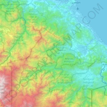
Name: Valle La Estrella topographic map, elevation, terrain.
Average elevation: 2,743 ft
Minimum elevation: -3 ft
Maximum elevation: 12,421 ft
Other topographic maps
Click on a map to view its topography, its elevation and its terrain.
Limón
Limón, Cantón Limón, Limón Province, 70101, Costa Rica
Average elevation: 20 ft