
Make a donation
Gear up for your next adventure:
As an Amazon Associate, this site earns from qualifying purchases at no extra cost to you.
Tupiza topographic map
Click on the map to display elevation.
Make a donation
Gear up for your next adventure:
As an Amazon Associate, this site earns from qualifying purchases at no extra cost to you.
Tupiza
Tupiza is a city in Potosí Department, Bolivia. It is located at an elevation of about 2850 m. The population is 25,709 (2012 estimate). Tupiza and its environs are characterized by dramatic red escarpments which jut ruggedly skyward from the coarse, gray terrain; green agricultural land adjacent to the nearby Tupiza River provides welcome respite from the otherwise arid, thorny surroundings. The area quebradas are susceptible to flash flood runoff from sudden cloudbursts.
Make a donation
Gear up for your next adventure:
As an Amazon Associate, this site earns from qualifying purchases at no extra cost to you.
About this map
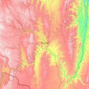
Name: Tupiza topographic map, elevation, terrain.
Location: Tupiza, Sur Chichas, Potosí, Bolivia (-21.85547 -66.33675 -21.06841 -65.24457)
Average elevation: 11,663 ft
Minimum elevation: 7,434 ft
Maximum elevation: 15,374 ft
Make a donation
Gear up for your next adventure:
As an Amazon Associate, this site earns from qualifying purchases at no extra cost to you.