
Frazione Puà topographic map
Interactive map
Click on the map to display elevation.
About this map
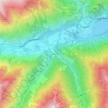
Name: Frazione Puà topographic map, elevation, terrain.
Location: Frazione Puà, Pratolungo, Vinadio, Coni, Piémont, Italie (44.27666 7.13779 44.31666 7.17779)
Average elevation: 4,278 ft
Minimum elevation: 2,762 ft
Maximum elevation: 6,791 ft
Other topographic maps
Click on a map to view its topography, its elevation and its terrain.
Podio Inferiore
Italie > Piémont > Coni > Pratolungo
Podio Inferiore, Pratolungo, Vinadio, Coni, Piémont, Italie
Average elevation: 4,213 ft