
Thank you for supporting this site ❤️
Make a donation
Make a donation
Gear up for your next adventure:
As an Amazon Associate, this site earns from qualifying purchases at no extra cost to you.
Adorf/Vogtland topographic map
Click on the map to display elevation.
Thank you for supporting this site ❤️
Make a donation
Make a donation
Gear up for your next adventure:
As an Amazon Associate, this site earns from qualifying purchases at no extra cost to you.
About this map
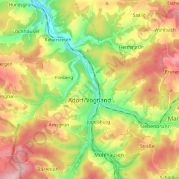
Name: Adorf/Vogtland topographic map, elevation, terrain.
Location: Adorf/Vogtland, Vogtlandkreis, Saxony, 08626, Germany (50.28822 12.17608 50.36328 12.30987)
Average elevation: 1,742 ft
Minimum elevation: 1,352 ft
Maximum elevation: 2,185 ft
Thank you for supporting this site ❤️
Make a donation
Make a donation
Gear up for your next adventure:
As an Amazon Associate, this site earns from qualifying purchases at no extra cost to you.