
Olonkinbyen topographic map
Interactive map
Click on the map to display elevation.
About this map
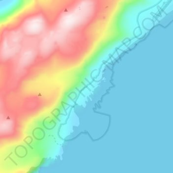
Name: Olonkinbyen topographic map, elevation, terrain.
Location: Olonkinbyen, Jan Mayen, Norwegen (70.90245 -8.73599 70.94245 -8.69599)
Average elevation: 502 ft
Minimum elevation: -16 ft
Maximum elevation: 1,696 ft
Olonkinbyen besteht aus wenigen, größtenteils baulich miteinander verbundenen und um zwei nach Westen offene Innenhöfe gruppierten Gebäuden. Es liegt auf dem schmalen Küstenstreifen etwa 150 m landeinwärts an der Südostküste im Südteil der Insel, im Windschatten des bis zu einer Höhe von über 750 m aufragenden Bergrückens, der den Südteil der Insel durchzieht.
Other topographic maps
Click on a map to view its topography, its elevation and its terrain.