Geolocate

Bramford topographic map

Click on the map to display elevation.

About this map

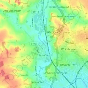
Name: Bramford topographic map, elevation, terrain.

Location: Bramford, Mid Suffolk, Suffolk, England, United Kingdom (52.06514 1.04381 52.09686 1.11373)

Average elevation: 85 ft

Minimum elevation: 7 ft

Maximum elevation: 203 ft

Gear up for your next adventure:

🛏️Cold Weather Sleeping Bag - Warm sleeping bag for cold conditions
🌧️Backpack Rain Cover - Keep gear dry in wet weather
🦶Carbon Trekking Poles - Reduce knee impact on steep descents with ultra-light poles
🥇GPS Hiking Watch - Multi‑sport GPS watch with navigation and trail tracking
🪵Folding Camp Saw - Compact saw for wood and campsite work

As an Amazon Associate, this site earns from qualifying purchases at no extra cost to you.