
Uelleben topographic map
Interactive map
Click on the map to display elevation.
About this map
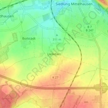
Name: Uelleben topographic map, elevation, terrain.
Average elevation: 1,079 ft
Minimum elevation: 981 ft
Maximum elevation: 1,184 ft
Other topographic maps
Click on a map to view its topography, its elevation and its terrain.
Siebleben
Deutschland > Thüringen > Landkreis Gotha > Gotha
Siebleben, Gotha, Landkreis Gotha, Thüringen, 99867, Deutschland
Average elevation: 974 ft